Interactive Map of Lawrence
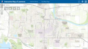
Interactive Map of Lawrence
New mobile-friendly version of the map that works with any web browser and most mobile devices including iOS and 'Droid tablets and smart phones. The map includes all the same functionality of the previous version and more. Search an address, download a subdivision plat, find historic properties, discover if a property is in the flood plain, check out the status of roads in your neighborhood, measure and draw on the map and print to PDF, JPG or other file formats.
Crime Map
Crime Map of Lawrence, KS - visual representation of present and past criminal activity
City Facilities
Interactive map of City Facilities
Environmental Baseline Map
Flood Hazard Area Map
View 2015 and 2010 FEMA flood information: Flood Hazard Area Map
Historic Resources Map
Neighborhood Association Finder
Find your Neighborhood Association
Parking Map
Pavement Condition Index Map
Prime Soils Map
Snow Operations Map
Snow Operations Information and Maps
Stormwater Program Map
Tax Assessed Property Map
Interactive map of certified special assessments in Lawrence.
Transit routes
View Lawrence Transit Bus Routes
Traffic Counts
Traffic Camera Map
Trash, Yard Waste and Recycling Pick-Up Days
View trash, yard waste and recycling pick-up days through the city.
Truck Routes
Truck Routes PDF Map
Cemetery Map
NOTE: As of 3/3/2021 data is not updated due to new system implementation